
Site Mapping
Here is a quick tutorial about how I use Google maps and the Procreate app to make quick, to-scale maps for our farm. We use these for crop planning, garden design, staff assignments, and facilities growth (for mapping underground utilities).
I communicate best visually and I find that having a site map that shows our current facilities, fields, etc. and any planned changes can be the most efficient way to help others understand our direction.
I’m using an iPad and Apple Pencil with the Procreate app. I have a Paperlike screen cover on my iPad (it is a clear matte finish that you can’t see). This cover helps make the Apple pencil feel more like I’m using on paper. It creates a little friction/drag. This has been really helpful for sketching out wedding floral designs for prospective clients.
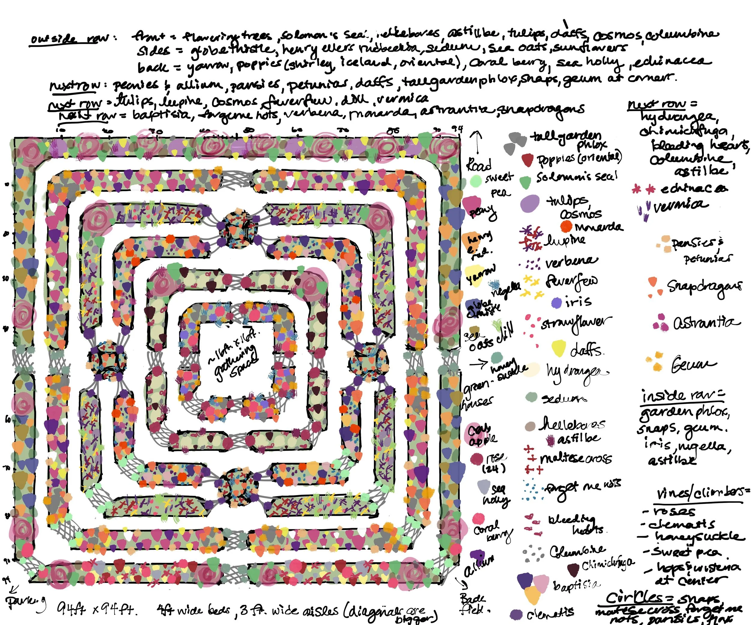
Here is the design I made for my own use for the hügelkultur display garden. Some things worked out the way I thought they would, some plants had to be moved around. I wouldn’t read too far into this in terms of companion planting. Remember- my choices here are based on my soil, water, temperatures, light, etc.
All things considered— the garden turned out pretty close to what you see here. And I can’t wait to see how it develops even more next season.
Questions about site mapping or digital drafting? Let me know. This is right up my former art teaching career alley.